Geosun GS-100G Handheld LiDAR Mobile Mapping System with 5cm Accuracy and 640K Points/Sec Data Capture
The Geosun GS-100G is a professional handheld LiDAR scanning system that combines GNSS, INS, LiDAR, and SLAM technologies for comprehensive indoor and outdoor 3D data collection. With its compact 2.15 kg design and versatile multi-platform operation, this system delivers high-precision mapping capabilities for various applications.
| Parameter | Specification |
|---|---|
| Point Cloud Accuracy | 5cm @ 100m without control point |
| Weight | 2.15 kg (with battery) |
| Battery Capacity | 11600 mAh |
| Storage | Built-in Flash memory 128GB, supports microSD 256GB |
| Voltage Range | 12V-18V |
| Working Temperature | -20℃ to 55℃ |
| Carrying Platform | Hand-held, Multi-rotor, and Vehicle |
| System Consumption | 25W |
| Parameter | Specification |
|---|---|
| Update Frequency | 200Hz |
| GNSS Signal Type | GPS L1/L2/L5, GLONASS L1/L2, BDS B1C/B1/B2/B2a/B2b/B3, Galileo E1/E5b/E5a |
| Position Accuracy | Horizontal 0.02m, Elevation 0.03m |
| Pitch Accuracy | 0.015° |
| Roll Accuracy | 0.015° |
| Heading Accuracy | 0.040° |
| Parameter | Specification |
|---|---|
| Detection Range | 80m @ 10%, Maximum Range 120m |
| Range Accuracy | ±1.5cm |
| Channels | 16 |
| Horizontal FOV | 360° |
| Vertical FOV | 270° |
| Points Rate | Single echo 320,000 Points/Sec, Dual echo 640,000 Points/Sec |
| Parameter | Specification |
|---|---|
| Resolution | 2 × 20 MP |
| FOV | Horizontal 270° |
| Shooting Mode | Isochronous |
- Compact and lightweight design at 2.15 kg for easy portability
- Multi-sensor integration: GNSS, INS, LiDAR, and SLAM algorithms
- High precision 5cm accuracy at 100m range
- Versatile platform support: hand-held, multi-rotor, and vehicle mounting
- High-speed data capture with up to 640,000 points per second
- Comprehensive 360° horizontal and 270° vertical field of view
- Extended battery life with 11600 mAh capacity
- Ample storage with 128GB built-in memory plus 256GB microSD support
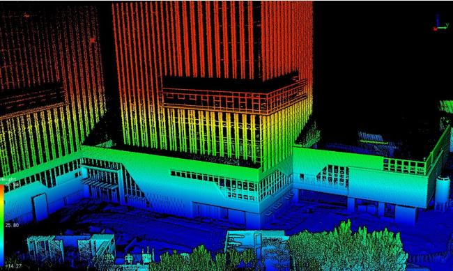
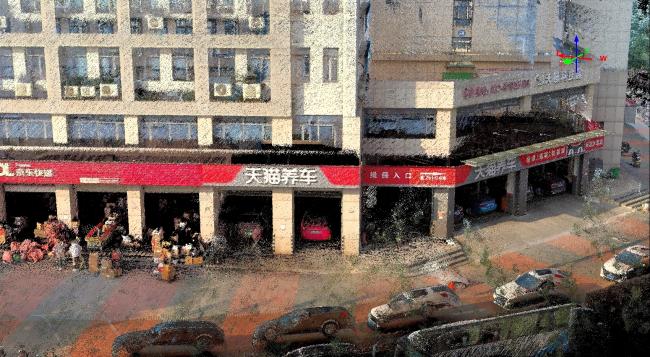
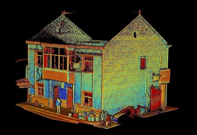
The GS-100G handheld LiDAR system captures high-quality 3D data for industrial park mapping, building documentation, and infrastructure surveys. The system provides clear, detailed point cloud data suitable for various professional applications.
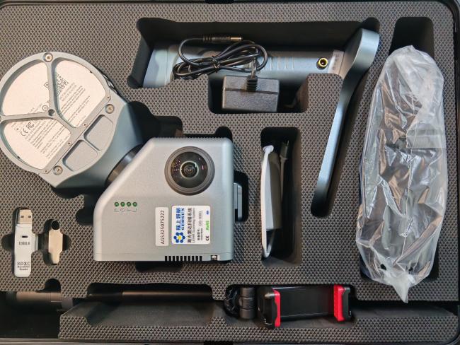
The Geosun GS-100G Handheld LiDAR system is securely packaged in a protective EVA-lined suitcase, enclosed within a durable hard carton box. This packaging ensures safe transportation for both air and sea shipments.

Get in Touch
Have questions about our products or want to discuss a custom order? Our team is ready to help you.