
TEM Transient Geophysical Electromagnetic Equipment For Underground Exploration
TEM Transient Electromagnetic Geoohysical Method Electromagnetic Geophysical Equipment for Underground Exploration
WHAT IS TEM?
The TEM (Transient Electromagnetic) method is a geophysical technique used to obtain vertical resistivity soundings, focusing on conductive materials that exhibit significant responses. This non-destructive approach involves the use of wire loops to transmit and receive signals in the subsurface, ensuring minimal disturbance to the survey area and leaving no residual marks after measurements are completed.
WHAT CAN IT BE USED FOR?
Transient Electromagnetic (TEM) can be used for:
- Mineral exploration to locate conductive mineral deposits.
- Groundwater exploration to map aquifers and assess hydrogeological properties.
- Environmental studies to detect subsurface contamination and monitor landfill sites.
- Engineering purposes, such as mapping subsurface conditions and assessing stability.
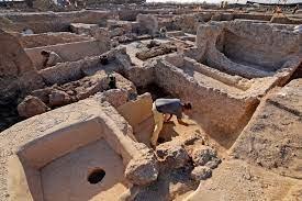
- Archaeological investigations to locate buried structures and artifacts.
- Geotechnical surveys to evaluate soil and rock properties.
- Hydrocarbon exploration to identify potential reservoirs and map geological structures.
HOW DOES WTEM WORK?
WTEM works by transmitting electromagnetic pulses into the ground using a transmitter loop. These pulses induce currents in the subsurface, which generate secondary electromagnetic fields. Receivers measure the response of these fields, allowing the interpretation of subsurface resistivity variations.
KEY FEATURE
- Lead synchronization technology: Allows for an extended ultra-high power detection range, reaching up to a thousand meters.
- Integration of superficial part and intermediate part: The instrument combines multiple functions in one machine, making it suitable for areas with complex geological environments, such as mountainous regions.
- IGBT bridge circuit: Enables the instrument to achieve high-power output and quick shut-off. This results in a portable electromagnetic transmitter.
- USB port data transfer: Facilitates easy transfer of data and enables interaction between the instrument and the user, enhancing usability.
- Wide range of applications: The instrument can be widely employed in various investigation tasks, including metal mining, coal fields, oil and gas fields, geothermal exploration, water resource surveys, and environmental pollution detection.
APPLICATION FIELD
|
Mineral |
Oil & gas |
Geothermal |
|
Groundwater |
Engineering and geotechnical |
Archaeological |


TECHNICAL SPECIFICATION
|
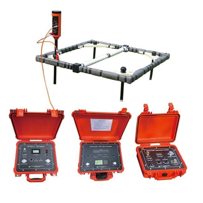
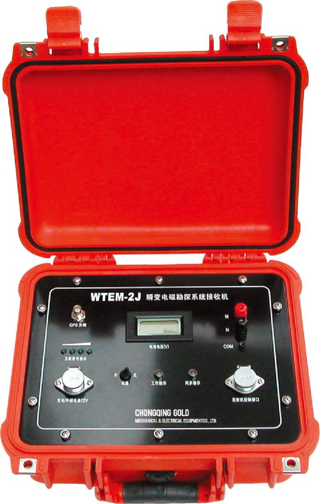
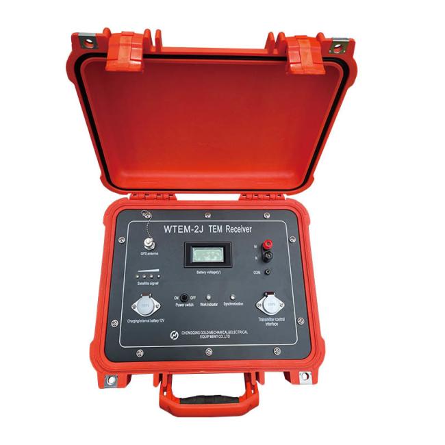
WTEM-2J/ GPS TEM Exploration system receiver
|
|
| Channel number | 1 |
| Pre-amplifier gain | 8, 32 times |
| Main amplifier gain | 1, 2, 4, 8, 16, 32, 64, 128 times |
| Band pass | 0~50kHz(liner phased filter), full band 0~400kHz |
| A/D bit | 16bit |
| The minimum sample interval | 1 μs |
| Crystal oscillation total error | ≤5*10-9 |
| Trace number | 50 |
| Stack number | 1~9999 |
| Synchronization mode | (1) Cable synchronization (2)GPS synchronization |
| Power supply | Built-in 12V rechargeable battery(support outside power), working time≥10 hours |
| Working temperature | -10℃~+50℃ |
|
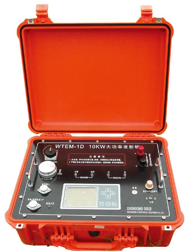
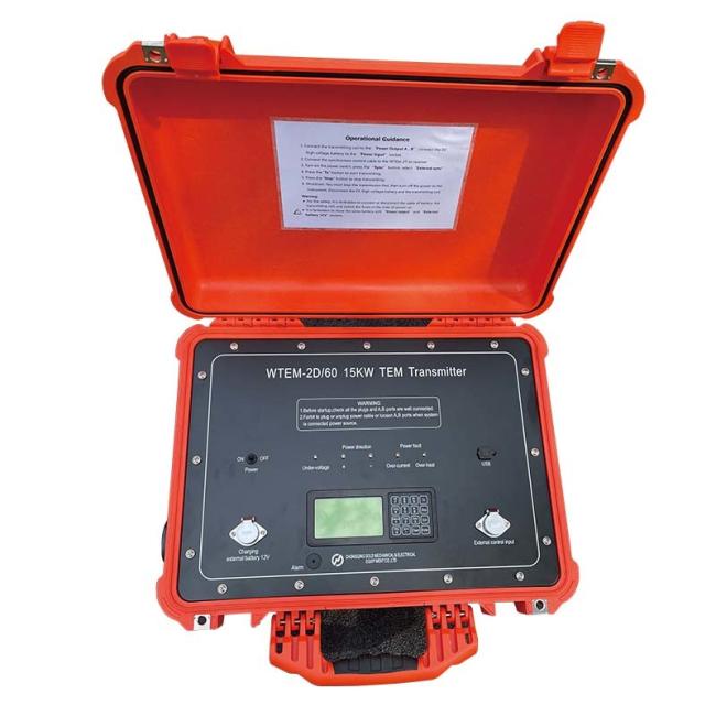
WTEM-1D 10KW Large power transmitter
|
|
| Transmitting voltage | 200V |
| Transmitting current | 50A |
| Current measurement precision | 1% |
| Power supply frequencies | 0.0625Hz, 0.125Hz, 0.25Hz, 0.5Hz, 1Hz, 2Hz, 4Hz, 8Hz, 16Hz, 32Hz |
| Transmitting power voltage display | Liquid crystal display unit V, display resolution 0.1V |
| Working temperature | -10℃~+50℃ |
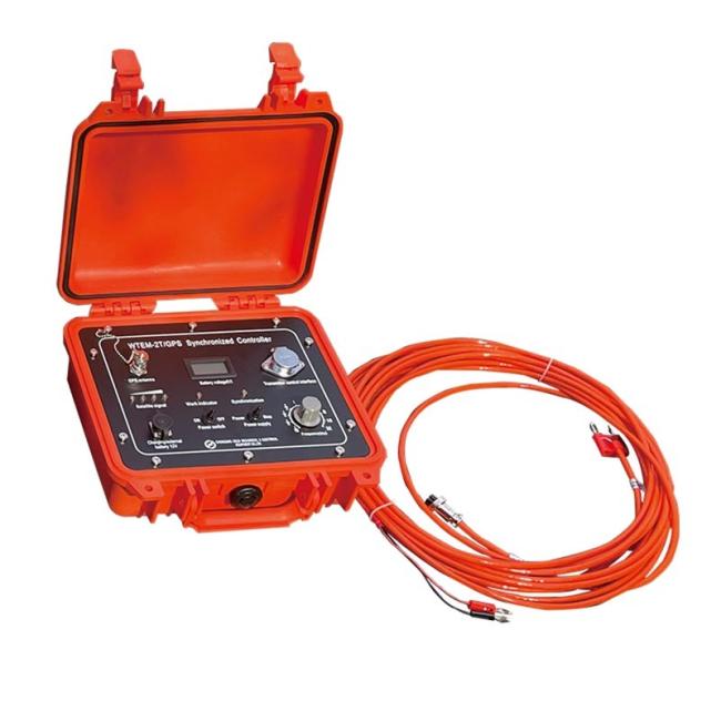
PRODUCT DETAILS
ABOUT US


Get in Touch
Have questions about our products or want to discuss a custom order? Our team is ready to help you.