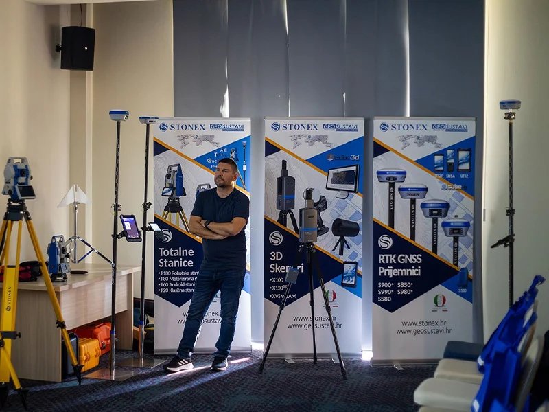
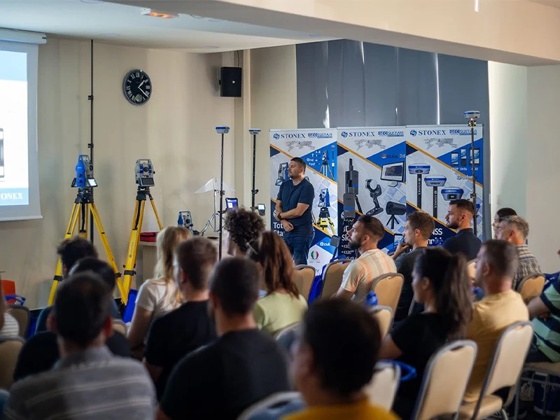
Geodetske škole imaju ključnu ulogu u pružanju učenicima potrebnog znanja i vještina u području geodezije.Integracija najnovijih
geodetskih instrumenata u takve obrazovne ustanové može značajno poboljšati iskustvo učenika i bolje ih pripremiti za primjenu u
stvarnom svijetu.Najnoviji geodetski instrumenti nude napredne značajke i mogućnosti koje mogu pružiti studentima intenzivnije
iskustvo učenja.Korištenjem ovih instrumenata, studenti mogu steći praktično iskustvo u prikupljanju podataka, analizi itumačenju, što su ključne vještine u području geodezije.
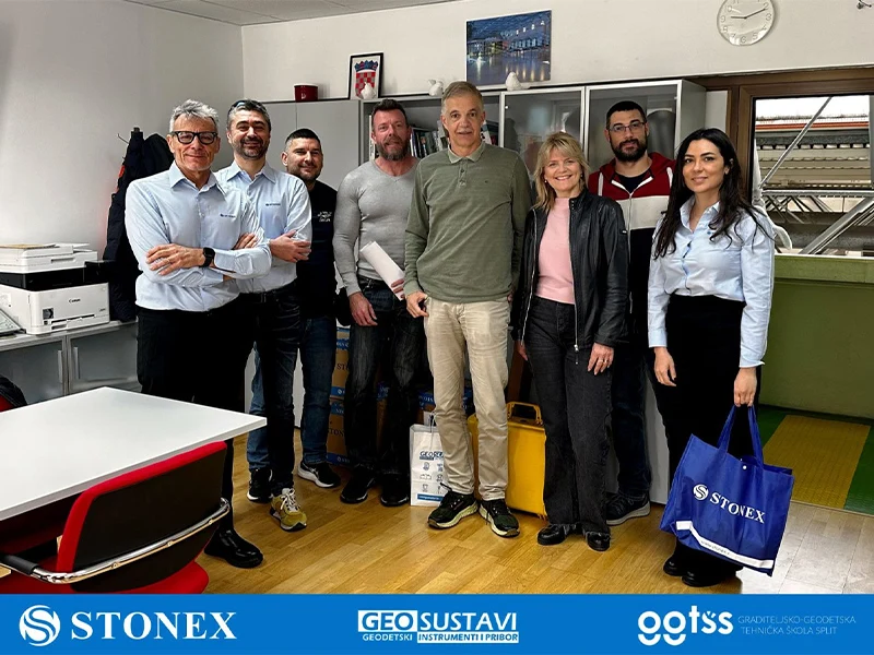
U suradnji sa STONEX S.r.l. Italija, geodetskoj školi u Splitu isporučili smo najnovije totalne stanice, teodolite i GNSS prijemnike.

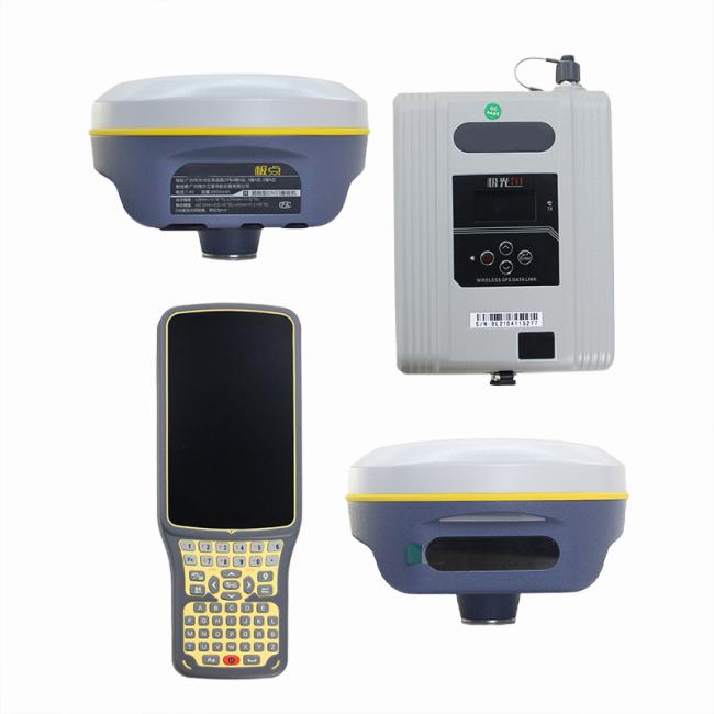
New Version GPS RTK SOUTH Galaxy G2 G3 G1PLUS With 1598 Channels And Imu In Land Surveying CHC i83 i73 RTK
Price:
$3,500.00
MOQ:
1 piece
Delivery Time:
30 work day
Brand:
SOUTH
Product Description
New Version GPS RTK SOUTH Galaxy G2 G3 G1PLUS With 1598 Channels And Imu In Land Surveying CHC i83 i73 RTK
Products Description
| Specification | ||
| GNSS Features | Channels | 1598 |
| GPS | L1, L1C, L2C, L2P, L5 | |
| GLONASS | G1, G2, G3 | |
| BDS | BDS-2: B1I, B2I, B3I | |
| BDS-3: B1I, B3I, B1C, B2a, B2b* | ||
| GALILEOS | E1, E5A, E5B, E6C, AltBOC* | |
| SBAS | L1* | |
| IRNSS | L5* | |
| QZSS | L1, L2C, L5* | |
| MSS L-Band (Reserve) | ||
| Positioning output rate | 1Hz~20Hz | |
| Initialization time | < 10s | |
| Initialization reliability | > 99.99% | |
| Positioning Precision | Code differential GNSS positioning | Horizontal: 0.25 m + 1 ppm RMS |
| Vertical: 0.50 m + 1 ppm RMS | ||
| GNSS static | Horizontal: 2.5 mm + 0.5 ppm RMS | |
| Vertical: 5 mm + 0.5 ppm RMS | ||
| Real-time kinematic | Horizontal: 8 mm + 1 ppm RMS | |
| (Baseline<30km) | Vertical: 15 mm + 1 ppm RMS | |
| SBAS positioning | Typically < 5m 3DRMS | |
| RTK initialization time | 2 ~ 8s | |
| IMU tilt compensation | Additional horizontal pole tip uncertainty | |
| typically less than 10mm + 0.7 mm/° tilt down to 30° | ||
| IMU tilt angle | 0° ~ 60° | |
| Hardware Performance | Dimension | 130.5mm(φ) × 84mm(H) |
| Weight | 850g (battery included) | |
| Material | Magnesium aluminum alloy shell | |
| Operating temperature | -25℃ ~ +65℃ | |
| Storage temperature | -35℃ ~ +80℃ | |
| Humidity | 100% Non-condensing | |
| Waterproof/Dustproof | IP68 standard, protected from long time immersion to depth of 1m IP68 standard, fully protected against blowing dust | |
| Shock/Vibration | Withstand 2 meters pole drop onto the cement ground naturally | |
| Power supply | 6-28V DC, overvoltage protection | |
| Battery | Inbuilt 6800mAh rechargeable, removable Lithium-ion battery | |
| Battery life | Single battery: 16h (static mode), 8h (Base + UHF), 12h (Rover + UHF), 15h (Rover + ) | |
| Communications | I/O Port | 5PIN LEMO external power port + Rs232 |
| Type-C interface (charge + OTG + Ethernet) | ||
| 1 UHF antenna interface | ||
| SIM card slot (Micro SIM) | ||
| Internal UHF | Radio receiver and transmitter, 1W/2W/3W switchable | |
| Frequency range | 410 - 470MHz | |
| Communication protocol | Farlink, Trimtalk450s, SOUTH, SOUTH+, SOUTHx, HUACE, Hi-target, Satel | |
| Communication range | Typically 8km with Farlink protocol | |
| Cellular mobile network | 4G cellular module standard, customizable 5G module | |
| 3.0/4.1 standard, 2.1 + EDR | ||
| NFC Communication | Realizing close range (shorter than 10cm) automatic pair between receiver and controller (controller requires NFC wireless communication module else) | |
| WIFI | Modem | 802.11 b/g standard |
| WIFI hotspot | Receiver broadcasts its hotspot form web UI accessing with any mobile terminals | |
| WIFI datalink | Receiver can transmit and receive correction data stream via WiFi datalink | |
| Data Storage/Transmission | Storage | 8GB SSD internal storage standard, extendable up to 64GB |
| Automatic cycle storage (The earliest data files will be removed automatically while the memory is not enough) | ||
| Support external USB storage | ||
| The customizable sample interval is up to 20Hz | ||
| Data transmission | Plug and play mode of USB data transmission | |
| Supports FTP/HTTP data download | ||
| Data format | Static data format: STH, Rinex2.01, Rinex3.02 and etc. | |
| Differential data format: CMR, SCMRx, RTCM 2.1, RTCM 2.3, RTCM 3.0, RTCM 3.1, RTCM 3.2 | ||
| GPS output data format: NMEA 0183, PJK plane coordinate, Binary code, Trimble GSOF | ||
| Network model support: VRS, FKP, MAC, fully support NTRIP protocol | ||
| Sensors | Electronic bubble | Controller software can display electronic bubble, checking leveling status of the carbon pole in real-time |
| IMU | Built-in IMU module, calibration-free and immue to magnetic interference | |
| Thermometer | Built-in thermometer sensor, adopting intelligent temperature control technology, monitoring and adjusting the receiver temperature | |
| User Interaction | Operating system | Linux |
| Buttons | Single button | |
| Indicators | 5 LED indicators | |
| Web interaction | With the access of the internal web interface management via WiFi or USB connection, users are able to monitor the receiver status and change the configurations freely | |
| Voice guidance | It provides status and operation voice guidance, and supports Chinese/English/Korean/Spanish/Portuguese/Russian/Turkish | |
| Secondary development | Provides secondary development package, and opens the OpenSIC observation data format and interaction interface definition | |
| Cloud service | The powerful cloud platform provides online services like remote manage, firmware update, online register and etc. | |


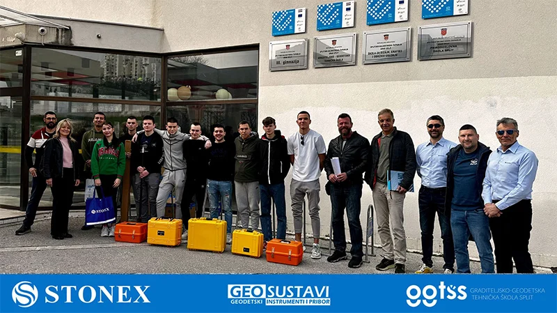
GEODETSKOJ ŠKOLI SPLIT isporučujemo STONEX totalne stanice, teodolite i GNSS prijemnike
Customer Photos
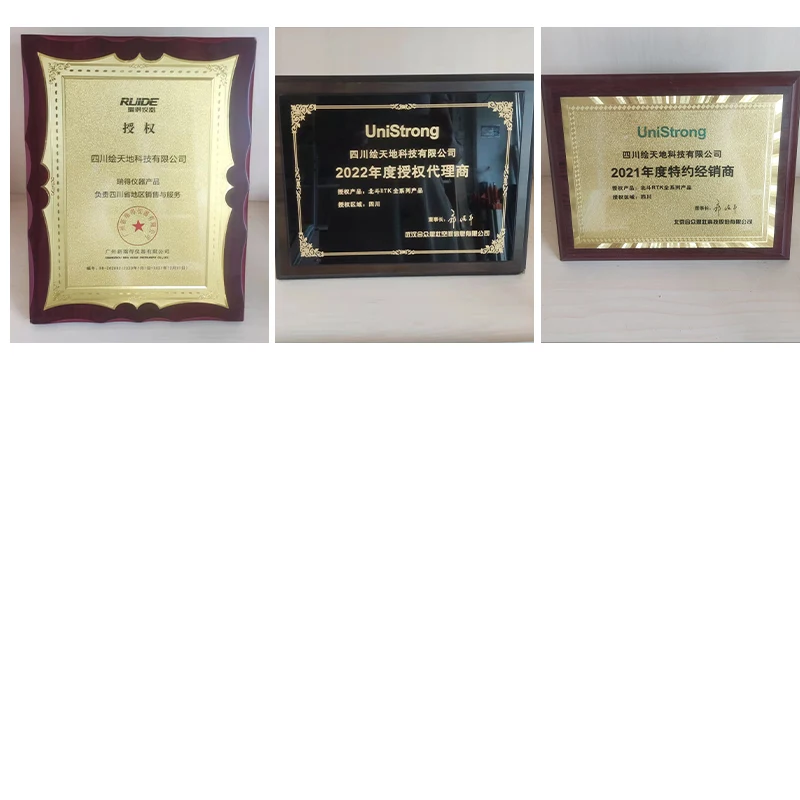
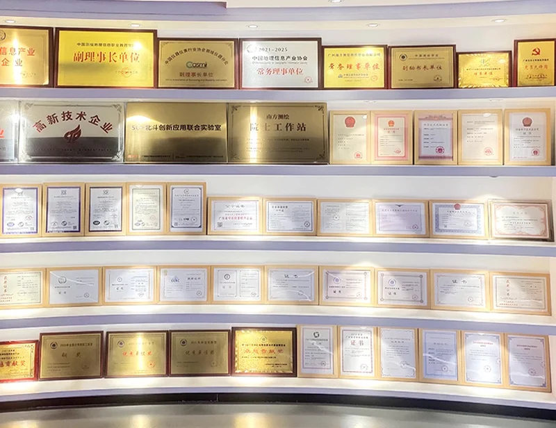
Certifications
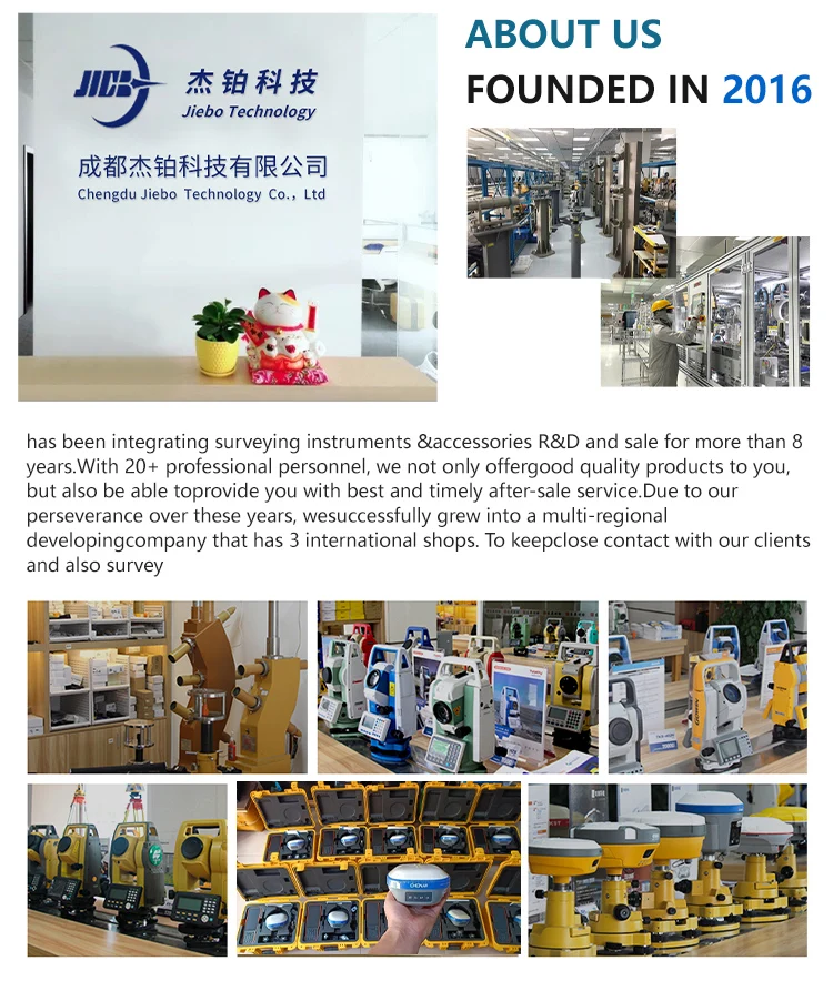
Company Profile
FAQ
1. who are we?
We are based in sichuan, China, start from 2016,sell to Africa(30.00%),Southeast Asia(16.00%),Mid East(11.00%),Eastern
Asia(10.00%),South America(10.00%),Central America(5.00%),South Asia(5.00%),Southern Europe(5.00%),North America(4.00%),Eastern
Europe(4.00%). There are total about 11-20 people in our office.
2. how can we guarantee quality?
Always a pre-production sample before mass production;
Always final Inspection before shipment;
3.what can you buy from us?
GNSS RTK,Total station,Level,Survey accessory,laser rangefinder
4. why should you buy from us not from other suppliers?
1.More than 20 years of experience in the trade field. 2.All products will have been strictly quality checked in factory before
sending out and all products have one year warranty.
5. what services can we provide?
Accepted Delivery Terms: FOB,CFR,CIF,EXW,FAS,CIP,FCA,CPT,DEQ,DDP,DDU,Express Delivery,DAF,DES;
Accepted Payment Currency:USD,EUR,JPY,CAD,AUD,HKD,GBP,CNY,CHF;
Accepted Payment Type: T/T,L/C,D/P D/A,MoneyGram,Credit Card,PayPal,Western Union,Cash,Escrow;
Language Spoken:English,Chinese,Spanish,Japanese,Portuguese,German,Arabic,French,Russian,Korean,Hindi,Italian
Our Service

Packing & Delivery

Similar Products
Get in Touch
Have questions about our products or want to discuss a custom order? Our team is ready to help you.
Company
Chengdu Jiebo Technology Co., Ltd.
Location
China Sichuan Chengdu No. 47, North 1st Section, Second Ring Road, Jinniu District
Contact Person
Lili Zhou