
Autel EVO II RTK Series V3: Industrial-Grade Precision Drone for Professional Use
The Autel EVO II RTK Series V3 is engineered for high-precision surveying, mapping, and industrial applications. Featuring advanced RTK positioning with multi-GNSS support (GPS, GLONASS, Galileo, BeiDou), it delivers exceptional positioning accuracy of ±1 cm + 1 ppm horizontal and ±2 cm + 1 ppm vertical for reliable mission-critical data.
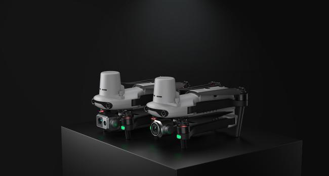
- Pro Model: 6K HDR 1-inch CMOS camera for ultra-detailed imagery and 4K/60fps video
- Dual 640T Model: Combines 640×512 radiometric thermal camera with visible light for thermal inspections and fault detection
- 42-minute maximum flight time
- 9 km OcuSync 3.0 transmission range
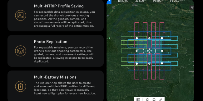
- Intelligent waypoint mission planning
- Multi-directional obstacle avoidance
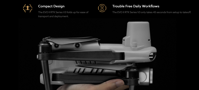
- Rugged foldable design for portability
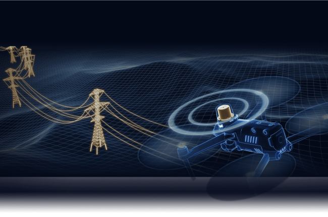
The EVO II RTK Series V3 features a new RTK module providing real-time centimeter-level positioning with Post-Processing Kinematic (PPK) support. The system records original satellite observation data and camera exposure parameters, supporting both RTK base stations and NTRIP RTK networks for stable data acquisition in challenging environments.
The EVO II Pro RTK V3 delivers high dynamic range and exceptional low-light performance for clear, detailed imagery with minimal distortion.
Features a 1-inch 6K CMOS image sensor with 20 megapixel resolution and advanced algorithms for clean, detailed imaging in twilight or night conditions.
f/2.8 ~ f/11 adjustable aperture provides control over lighting conditions and shutter speed.
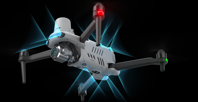
Incorporates 19 sensor groups including 12 visual sensors, ultrasound, and IMUs for real-time 3D mapping and path planning.
Get in Touch
Have questions about our products or want to discuss a custom order? Our team is ready to help you.