
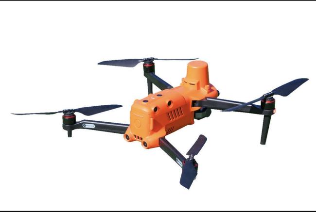
Industrial Portable Drone Survey Instrument X1 Quadrotor Drone For Surveying And Mapping
Price:
$2200-3300
MOQ:
1
Delivery Time:
10-30days
Brand:
CETU
Product Description
Autel Qianxun Surveing Mapping Drone Industrial 1237g X1 Quadrotor Flight Platform for Surveying Mapping

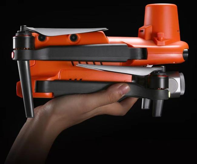
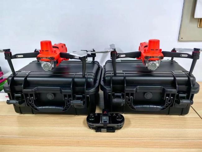
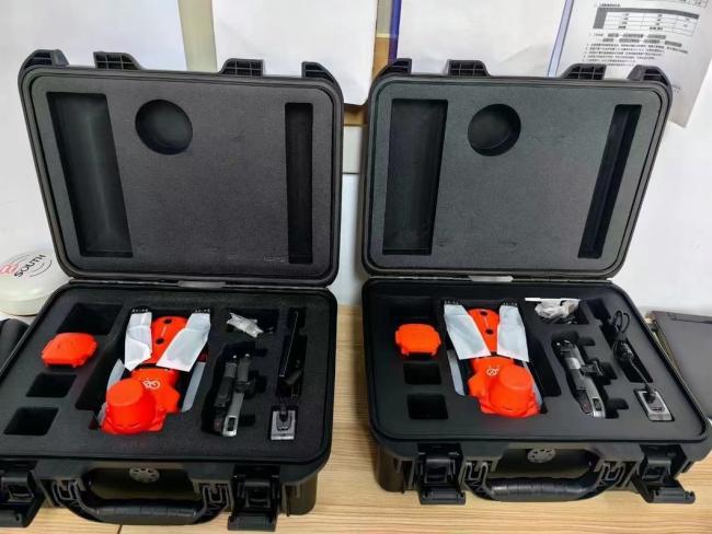
X1 quadrotor flight platform is a portable quadrotor flight platform specially designed for small area aerial photogrammetry. With the concept of "control points-free and flexible operation", it can meet the needs of extremely low input cost, extremely low difficulty in getting started and extremely flexible operation mode.
1. Base-station free
No need to erect a base station, real-time centimeter-level
positioning and PPK post-processing solution
2. High accuracy
No control points are required up to 1:500
3. More safety
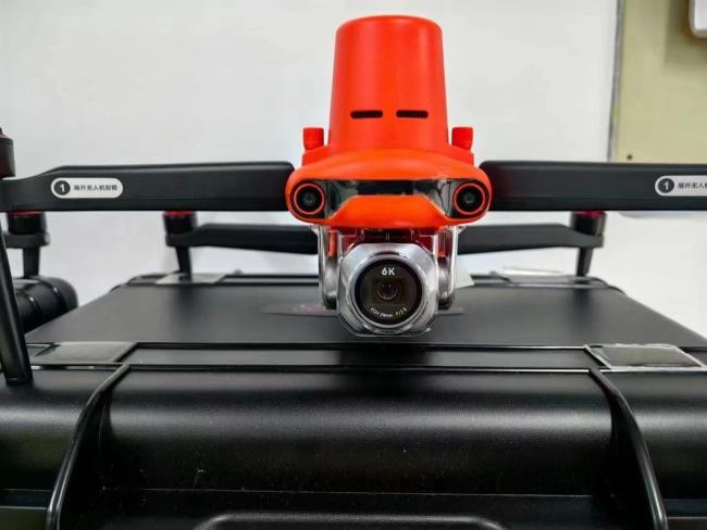
6 binocular 720° omni-directional obstacle avoidance design, with omni-directional "observation" obstacle
capability, for flight safety escort
4. More effective
No assembly, unfurl and fly, single sortie operation can reach more than 36 minutes
No need to erect a base station, real-time centimeter-level
positioning and PPK post-processing solution
2. High accuracy
No control points are required up to 1:500
3. More safety
6 binocular 720° omni-directional obstacle avoidance design, with omni-directional "observation" obstacle
capability, for flight safety escort
4. More effective
No assembly, unfurl and fly, single sortie operation can reach more than 36 minutes

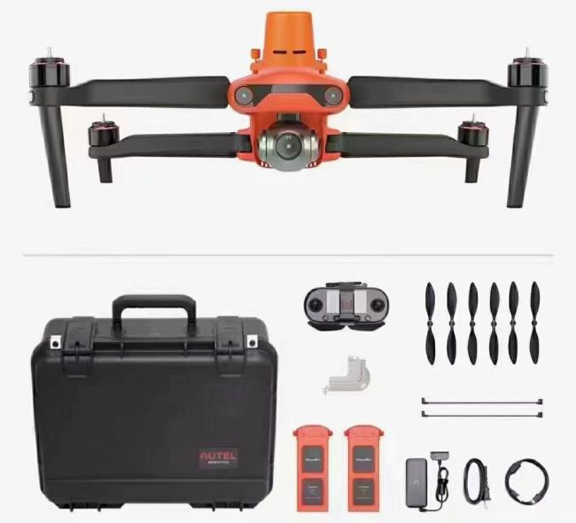
| Aircraft | |
| weight | 1237g |
| wheelcase | 397mm |
| Maximum flight time | 36mins(No wind conditions |
| Maximum wind resistance | Strong gale up to LV.8 |
| Maximum take-off altitude | 6000m |
| Radio operating frequency band | 2.4GHz To 2.4835GHz |
| Hover accuracy | When RTK is enabled and RTK works Horizontal: ±0.1m Vertical: ±0.1m |
| Without RTK enabled: Horizontal: ±0.3m (when visual positioning is working normally) ±1.5m (when GNSS positioning is working normally) Vertical : ±0.1m (when visual positioning is working normally) ±0.5m (GNSS positioning when normal operation) |
|
| RTK module | |
| Frequency point | GPS:L1/L2 GLONASS:L1/L2 Beidou satellite: B1/B2 Galileo satellite:E1/E5 |
| Time to first fix | <50s |
| Positioning accuracy | Horizontal:1cm+1ppm (RMS)
Vertical: 1.5+1ppm (RMS)
|
| Camera | |
| Sensor type | 1 inch CMOS, 20 million effective pixels |
| Field angle | FOV82° |
| Camera aperture | f/2.8-f/11 |
| Focusing range | 1m to infinity |
| Equivalent focal length | 28.6mm |
| Zoom range | 1-8x (maximum 3x lossless zoom) |

Similar Products
Get in Touch
Have questions about our products or want to discuss a custom order? Our team is ready to help you.
Company
Nanjing Cetu Surveying Instrument Co., Ltd.
Location
No. 36, Xinmofan Road, Nanjing, Jiangsu, China
Contact Person
Wang